
According to archeological founds, 'Uluru - Kata Tjuta National Park' and the surrounding region have been populated for at least 22.000 years. The rock formations had been called Ayers Rock and Olgas for about 100 years. Ever since the area was given back to the Aboriginals (26th October 1985), they have been called by their official names, Uluru and Kata Tjuta, like they had been for many thousands of years. Back in 1985, the airport, motels and the camping site right next to the Uluru were pulled down and the new Yulara Resort opened in 18 km distance.
The first thing we noticed when arriving at Yulara airport were millions of little flies. Those little small pests don't bite; however, they really do get to you as they don't leave you alone and basically crawl all over your face and body all the time. So we first went to the resort and got ourselves fly nets, thus protecting at least our heads. In March they've got autumn there with temperatures between 30° - 35°C during the day - and our tour guide was telling us that the flies would soon all be gone as they only live for a few days and do no longer have young ones while there is frost at night right through to spring.
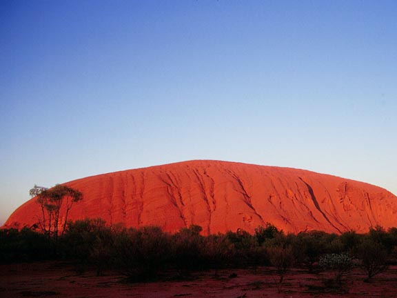
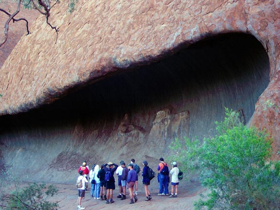
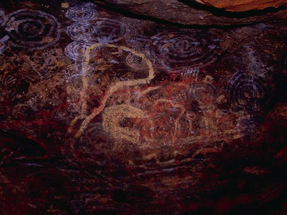
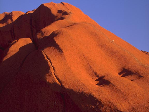
The Uluru (24 kB) ranks amongst the world's biggest monolithes and is 348 m high. Seen from afar, its surface appears to be totally even and smooth. However, when getting closer, you notice the ravages of time have had their strong impact, creating most impressive formations such as 'The Brain' (29 kB) over the past thousands of years. If water accumulates at certain spots, it reinforces erosion. Therefore even more water may collect and the rocks get undermined (56 kB). At some stage, the overhanging rock gets too heavy and breaks off. The broken pieces look like frozen waves. Those rock formations are holy places to the Aboriginals and there are certain spots visitors are not allowed to enter. Still, a few of these old rock paintings (53 kB) may be visited. Around Uluru, people keep explaining and stressing that it is a holy place for Aboriginals, however, at the same time, there are even metal bars with chains in between on the way up to the top of the Uluru, called 'The Climb' (35 kB). Should you still want to climb up there, please bear in mind to take enough water or other drinks with you
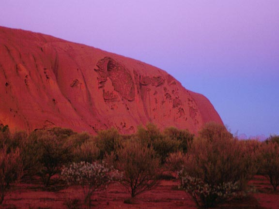
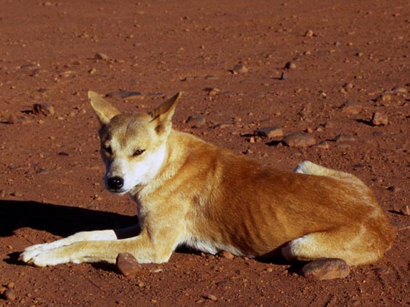
At sunset, thousands of people come here to the Uluru. There are two places - one for buses, one for cars - where you may see the sun going down. You see tourists standing in the spinifex gras and waiting for something special to happen but basically all there is is that it's getting darker. Tourists on package tours usually put beer benches right in between and sip champagne from paper cups. There are more idyllic spots surely to watch natural phenomenon. Early in the morning, it's the same procedure at the places for the sunrise. When walking round Uluru, we fortunately got to see a dingo (51 kB) which are normally very shy.
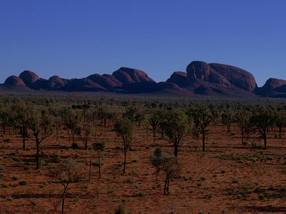
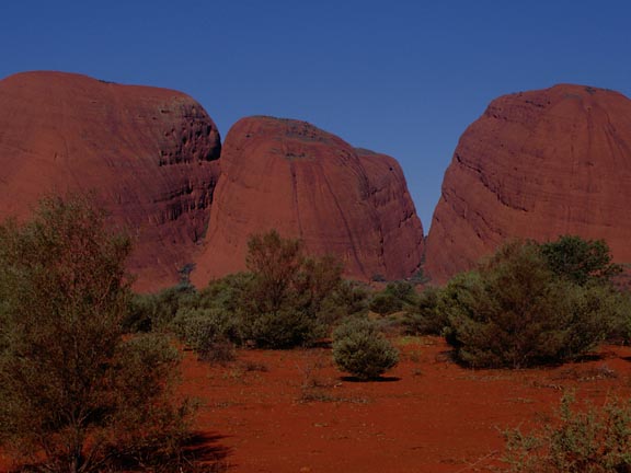
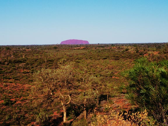
Kata Tjuta is about 40 km away and may still be seen with the naked eye (View from Kata Tjuta to Uluru, 63 kB). As one may tell from the translation of the Aboriginal name Kata Tjuta (many heads), it's a formation of 36 hilltops (43 kB) towering up to 535 m. There are deep valleys (36 kB) keeping the humidity and thus creating subtropic vegetation. A really nice walk starts near 'Valley of the Winds' (32 kB).
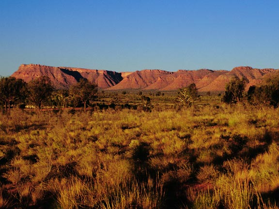
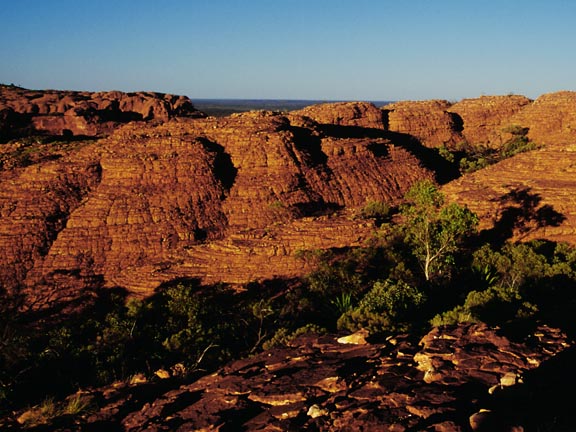
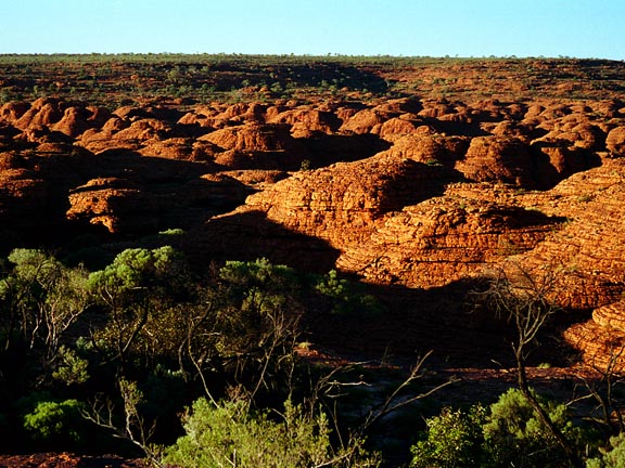
Afterwards, we drove on a circuit to Kings Canyon into the George Gill Ranges (58 kB). We got up very early in the morning, even before sunrise, and could see the shadows slowly vanishing, therefore enabling a view of the bizarre area (68 kB). There's a walk of about one hour next to the river. What is more spectacular is the 'Kings Canyon Walk' as this is the only way you can see the 'Garden of Eden' and 'Lost City' (86 kB). It takes between three and four hours, to do the 6 km. During summer, this path (48 kB) is even more exhausting surely as there's no shade most of the time.
From Kings Canyon we drove on to Alice Springs and took the plane to Adelaide. Although Todd River had flooded in Alice about two months earlier, the riverbed (53 kB) was totally dry when we got there.
|
|

|
|
|
|
|
|
|
|
|
|
|
|

|
last update: 24.11.1999